Smarter Water Planning with AI-Powered Precipitation Modeling

Client’s Background
Founded in 1899 in Osaka, Japan, Suntory Group has grown from a family-owned business into a global leader in the beverage industry. The company produces a wide range of products, including soft drinks, bottled water, coffee, tea, and alcoholic beverages. With operations spanning the Americas, Europe, Africa, Asia, and Oceania, Suntory reported $20.3 billion in annual revenue in 2024 and employs over 41,000 people worldwide.
Guided by its corporate message, “Living with Water,” Suntory is deeply committed to protecting this vital resource. Using water carefully, returning it to nature, and understanding its water cycle is central to the company’s mission of contributing to a sustainable society. Through Suntory Global Innovation Center, the company conducts advanced research to deepen its understanding of the natural water cycle.
Challenge
As climate change continues to reshape weather patterns worldwide, both the amount and patterns of precipitation have become increasingly unpredictable and uneven. Accurately monitoring water resources—and developing a deep understanding of the water cycle—is now essential to securing both current and future freshwater supplies.
This is particularly challenging in mountainous regions, where Suntory operates key facilities to advance its understanding of the water cycle. In these areas, complex terrain makes precipitation estimation especially difficult. Existing methods—such as satellite data, weather stations, and river flow monitoring—each have critical limitations. Satellite data and ground stations often underestimate precipitation in mountainous regions and lack the spatial resolution to capture local variation. River flow data reflects only area-wide averages, requiring complex adjustments for infiltration, evapotranspiration, and other factors.
To support its mid- to long-term sustainability initiatives, Suntory employs a water cycle simulation model to visualize how water moves through specific terrain. However, building this model—and achieving a truly high-resolution understanding of water circulation—requires accurate, localized precipitation data that current methods cannot provide. Addressing this gap necessitated a new approach: one that could reflect the unique characteristics of the landscape in far greater detail. To meet this need, Suntory partnered with Recursive on a technology development project, targeting two key regions for implementation: Nagano, Japan, and Segovia, Spain.
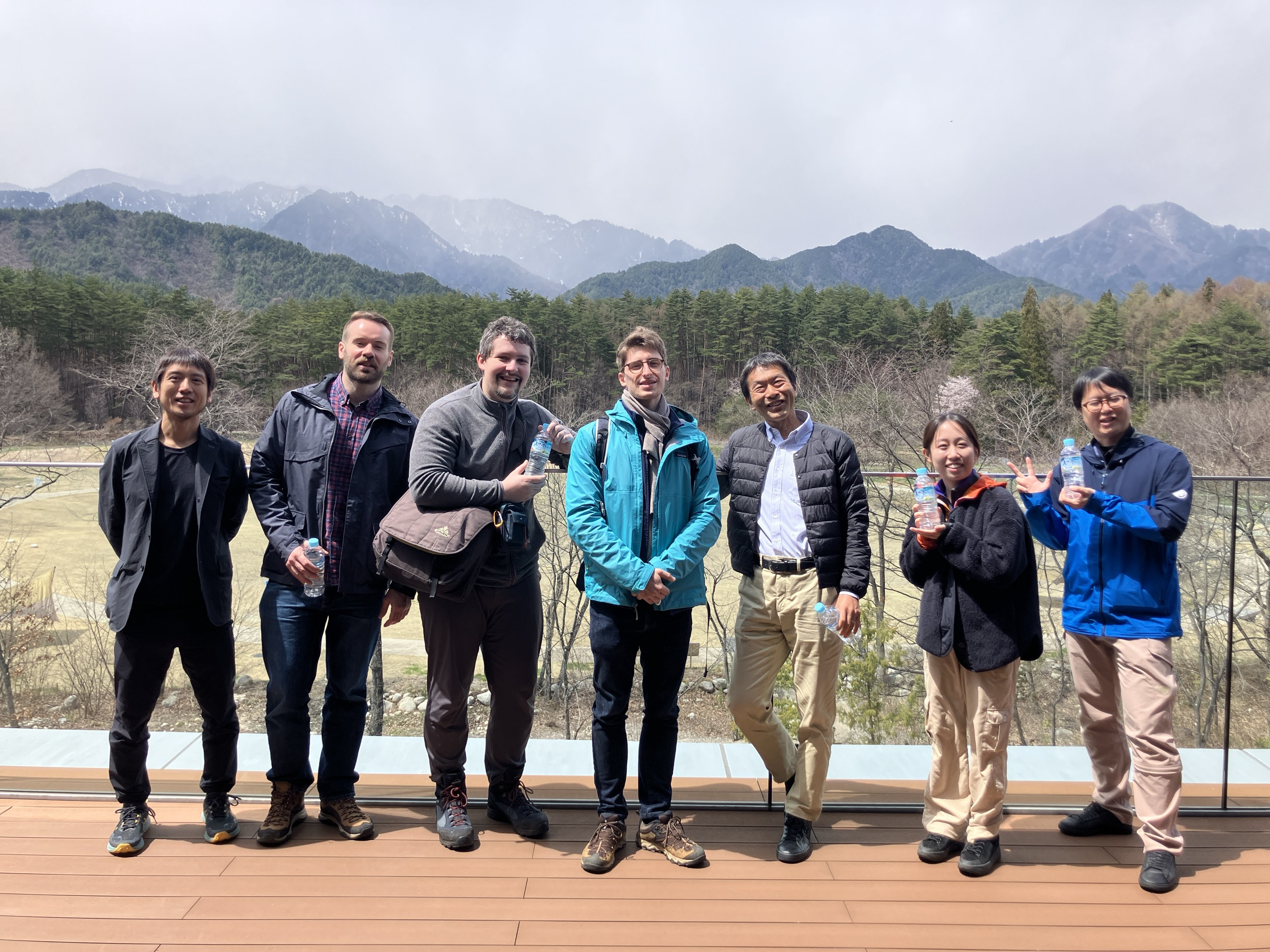
Recursive’s project team visits Suntory’s factory in Japan
Recursive’s Solution
To overcome the limitations of conventional methods and provide the high-resolution data needed for Suntory’s water cycle simulation, Recursive developed an AI-powered system that predicts localized rainfall variations with high spatial and temporal resolution—on a 1 km square grid and at hourly intervals—a level of detail difficult to achieve using traditional satellite or meteorological observatory data. The system delivers precipitation data at 28 times higher resolution than existing datasets.
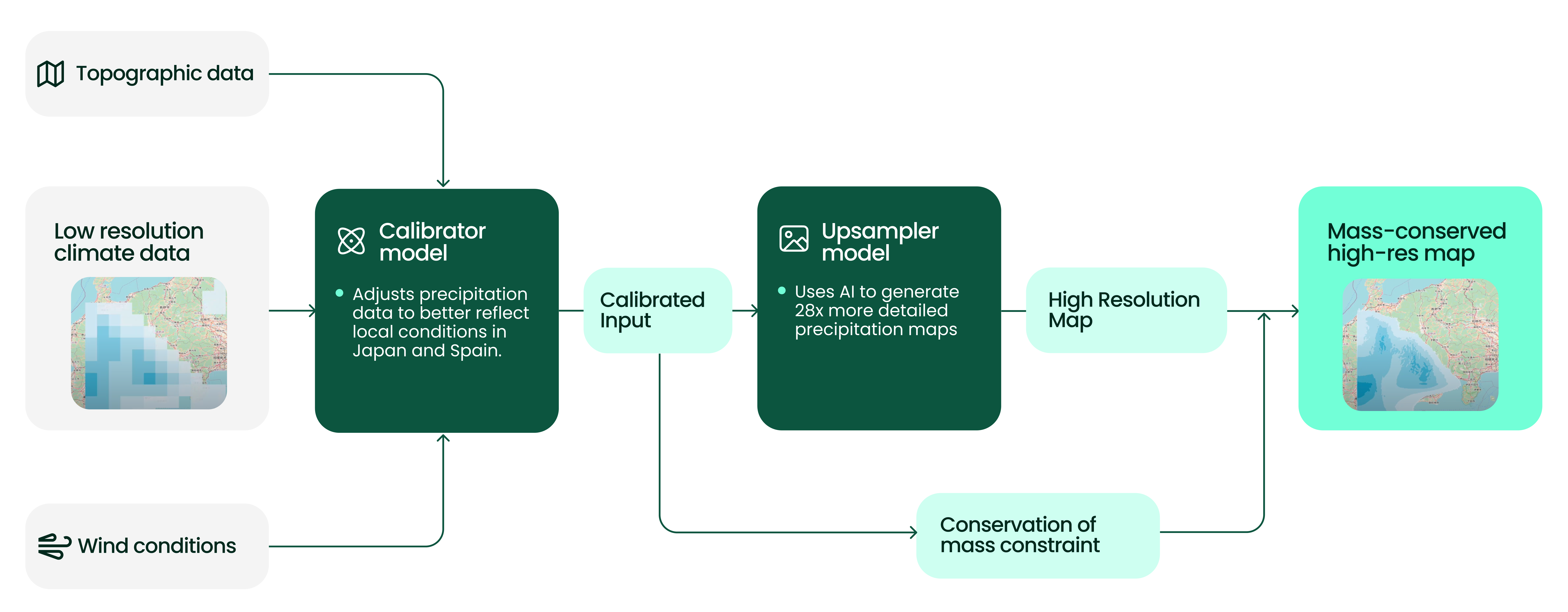
It combines low-resolution global climate precipitation data, topographic information, and wind conditions to create a broad but physically accurate representation of weather patterns. The AI then refines this input to produce precise, high-resolution precipitation estimates.
The system is composed of two main components:
- A calibrator model that adjusts precipitation data to better reflect local conditions in Japan and Spain. This step corrects for regional variations caused by factors such as elevation, wind, and seasonal differences.
- An upsampler model, which uses AI to generate highly detailed precipitation maps. Rather than filling gaps with simple averages, the model learns how precipitation typically behaves across different terrains and under various wind conditions, applying physical constraints to ensure results remain both realistic and consistent.
Results
- 20 years of hourly precipitation maps were generated for mountainous regions in both Japan and Spain.
- Delivered 28x higher spatial resolution compared to conventional datasets, with 1 km mesh precision.
- Achieved significant improvements in estimation accuracy compared to traditional methods.
- The solution is fully adaptable and can be applied to other regions, making it a scalable tool for high-resolution precipitation modeling wherever accurate water data is needed.
Voice of the customer

Recursive's AI solution have enabled high-resolution, localized rainfall prediction simulations, helping to gain deeper understanding of the water cycle and advance efforts to conserve water resources for future generations. We believe this project has demonstrated the usefulness of data utilization in water management.
Shun Kurihara, Institute of Water Science, Suntory Global Innovation Center Limited.